Natural Resources
STAFF: MARGO GHIA
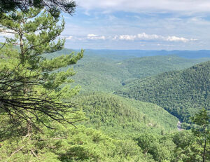
Working with municipalities, conservation commissions, and partnering organizations, the WRC conducts regional natural resource and land use planning with a goal to preserve our region’s resources and promote development that benefits both natural and human needs.
Natural resource planning encompasses many different topics, including forest blocks and wildlife connectors, watershed planning (see separate page), invasive species management, and land and water-based conservation planning. For more information on our work in any of these areas, contact Margo Ghia at mghia@windhamregional.org
Southeast Vermont Conservation Partnership
The Southeast Vermont Conservation Partnership is a collaborative of conservation organizations who are committed to bridging the gap between individual organizational efforts and larger landscape visions. Working together, we aim to conserve and steward the biologically rich landscape of Southeastern Vermont. Our goal is to have a connected and resilient landscape that will complement the needs of plants, animals and humans that call this region home. Support from the Catalyst Fund would enable our partnership to finalize our regional conservation goals and create an action plan that would guide our work into the future.
If you would like to learn more about the partnership, please contact WRC Natural Resource Planner Margo Ghia.
Invasive Species Management
WRC partners with local and state organizations with the goal of providing invasive species management education to municipalities and the general public.
Natural Resources Tools & Helpful Links
Online mapping tools:
For some help sheets on the Natural Resource and Flood Ready Atlases, visit WRC’s GIS Help Documents page.
- ANR Natural Resources Atlas: Geographic information about environmental features and sites that the Vermont Agency of Natural Resources manages, monitors, permits, or regulates.
- Vermont Flood Ready Atlas: The Vermont Flood Ready Atlas is an online-map tool that can help you identify critical facilities, transportation services and buildings in your community that are at risk of damage from flooding. The Atlas can also help you identify local watersheds and the extent of natural flood protection provided by forests, wetlands, floodplains and river corridors.
- ANR BioFinder: BioFinder is a map and database identifying Vermont’s lands and waters supporting high priority ecosystems, natural communities, habitats, and species. The most comprehensive assessment of its kind in Vermont, BioFinder was developed by the Agency of Natural Resources and partners to further our collective stewardship and conservation efforts.
For Municipalities / Conservation Commissions:
- The Association of Vermont Conservation Commissions promotes the advancement of conservation at the municipal level. There are a lot of resources on their site for newly forming or existing town conservation commissions.
- Vermont Fish and Wildlife Department: Specifically, the Community Wildlife Program provides municipal planners and non-governmental organizations with the most up-to-date information on conservation science and resources for implementing their conservation projects.
- Vermont Natural Resources Council: Offers a variety of resources to support communities in conserving and protecting natural resources through four program areas: Energy and Climate Action, Forests and Wildlife, Water, and Sustainable Communities.
For Landowners:
- Vermont Coverts: Provides training opportunities for landowners to learn about and support the natural resources and wildlife habitat on their land.
- VT DEC Citizen Science opportunities.