Village Base Maps
We have created a number of detailed, large-scale base maps and E911 maps of villages and downtowns. These that show building footprints (buildings as polygons instead of points), streets, and often sidewalks and other features. Addiional E911 maps can be found on WRC’s E911/Emergency Response Maps page.
Bellows Falls:
- 2015 E911 map, 36×48 inches
Bondville:
- 2010 base map, 8.5×14 inches
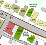
Jacksonville; all maps current to 2013:
- 2013 base map, 11×17 inches
- 2013 base map detail, center of village only, 8.5×11 inches
- 2013 simple B&W base map, center of village only, 8.5×11 inches
North Westminster:
- 2006 E911 map, 11×17 inches
Putney:
- 2003 base map, 36×36 inches
Readsboro:
- 2016 base map, village and surroundings, 18×24 inches
- 2016 base map, village core, 11×17 inches
- 2016 base map, village core, 8.5×11 inches
- 2016 simple base map, village core, 8.5×11 inches
- 2016 simple B&W base map, village core, 8.5×11 inches
- 2016 air photo map, village core, 8.5×11 inches
Saxtons River:
- 2015 E911 map 11×17 inches
South Newfane:
- 2006 base map, 18×36 inches
- 2006 base map, west half, 11×17 inches
- 2006 base map, east half, 11×17 inches
Townshend:
- 2009 base map, 11×17 inches
Weston:
- 2010 base map, 18×24 inches
- 2010 base map, 11×17 inches
Williamsville:
- 2006 base map, 11×17 inches
Wilmington:
- 2016 base map, downtown/village core, 11×17 inches
- 2016 simple B&W base map, downtown, 8.5×11 inches
- 2016 simple B&W base map, entire village area, 11×17 inches