E911-Emergency Response Maps
Many maps produced by WRC are useful for emergency response and planning. Paper copies can be ordered for a small fee, or PDF files can be downloaded.
Town E911 Address Maps
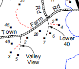
This series of large (generally 2×3 feet or 3×4 feet) color maps show roads, driveways, and structures with their E911 address for an entire town. These maps are available for only a few towns in the region (for other towns, see “Other Maps” at the bottom of this page):
- Dover, 2024, PDF (not all buildings are labeled)
- Guilford, 2026, PDF ← updated!
- Jamaica, 2023, PDF
- Londonderry, 2021, PDF
- Marlboro, 2025, PDF, PDF with contours ← updated!
- Somerset, 2011 (11×17), PDF
- Weston, 2024 PDF
- Wilmington, 2011, PDF
- Windham, 2012, PDF
Additionally, Vermont’s Enhanced 911 Board publishes E911 address atlases of each town the state. A listing and links to atlas can be found at https://e911.vermont.gov/maps-and-gis-data/map-books.
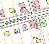
Village E911/Base Maps
We have created a number of E911/base maps of villages and downtowns that include building footprints with E911 addresses. Additional maps can be found on the WRC Village Base Maps page.
- Bellows Fallls (2015) E911 map, 9-page E911 atlas
- Jacksonville (2013) base map | base map detail
- North Westminster (2006) E911 map
- Readsboro village (2016) base map | base map village core 11×17 | base map village core 8.5×11 |
- Saxtons River (2015) E911 map
- Vernon village (2018) base map
- Weston village (2010) base map
- Wilmington village (2016) base map
Town Road Name Maps
These maps show all public and named private roads, road classification, and surface. A listing of available maps, with links to PDFs of all 11×17 maps, is available on WRC’s Road Name Maps page.