Watershed maps for Southeastern Vermont
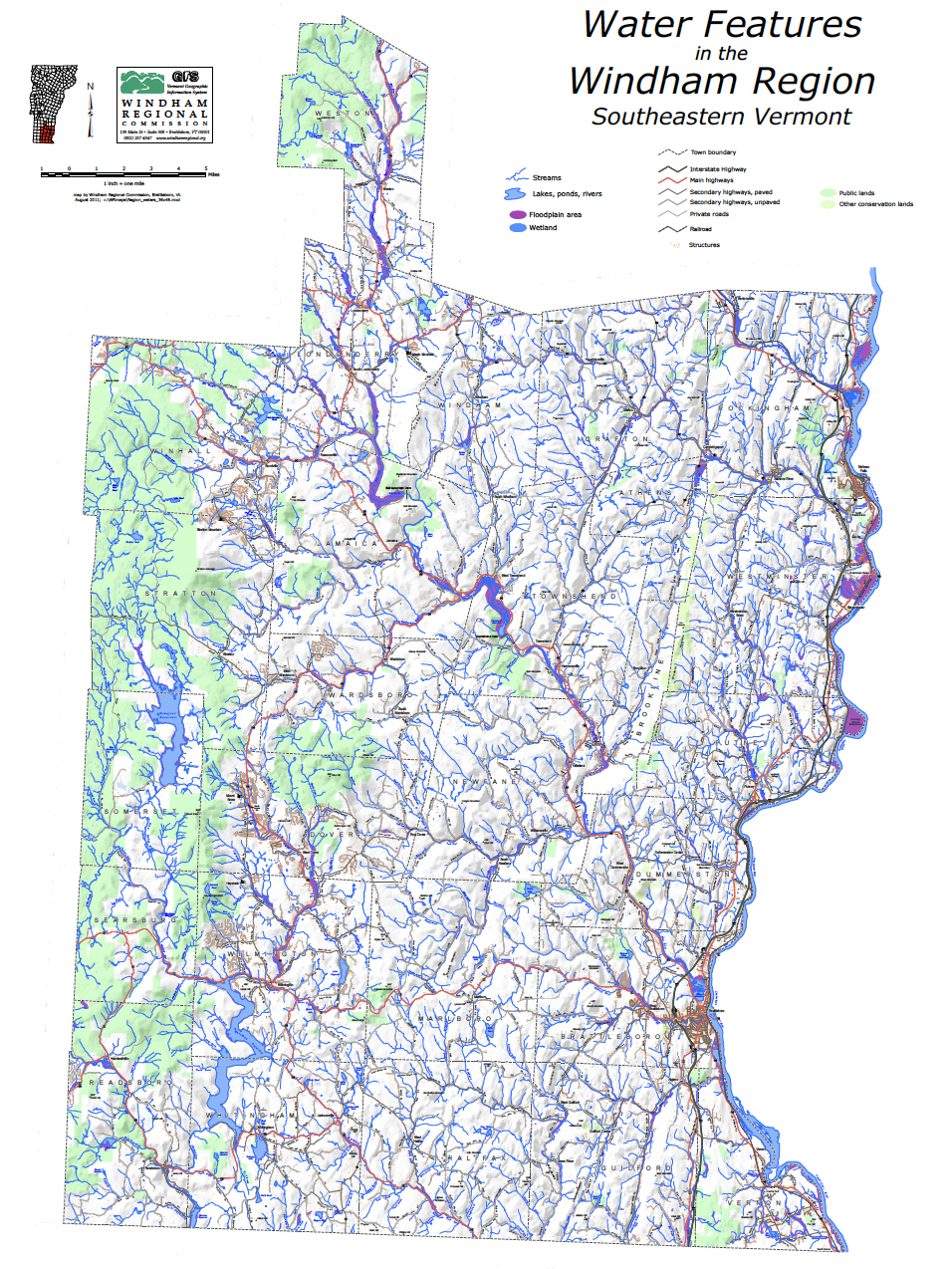
Water Features of the Windham Region
format: 36 x 48 inches, color, PDF, 9 megs
date: 2011 (does not include new stream names)
This large map shows many features of the Windham Region, with an emphasis on water. All surface waters in the Region, including their names, are shown, along with major wetlands and floodplain areas. Also shown are town boundaries, villages and hamlets, roads, structures, and public lands.
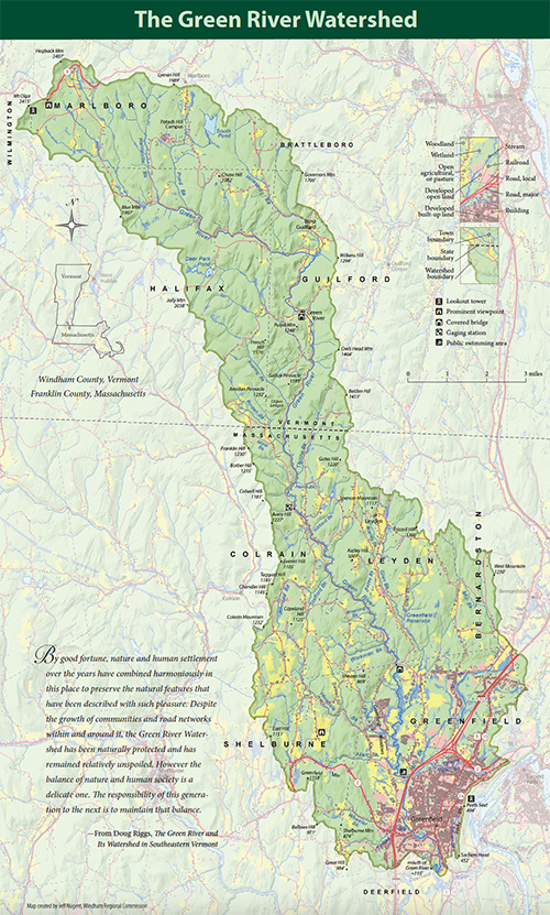
Green River Watershed, Brochure Map (land use & land cover)
format: 11.75 x 19.5 inches, PDF (13 megs)
date: 2022
This stunning map is the result of a collaboration between the Green River Watershed Alliance and the Windham Regional Commission. It is part of a larger brochure telling the story of the entire watershed. The map focuses on land use/land cover by displaying forest, open land, buildings, wetlands, and developed areas, but also includes towns, villages, roads, scenic views, covered bridges, lookout towers, mountains, hills, and stream names. To create this map, WRC cartographer Jeff Nugent received significant design assistance from Linda Lembke and Helen Menera.
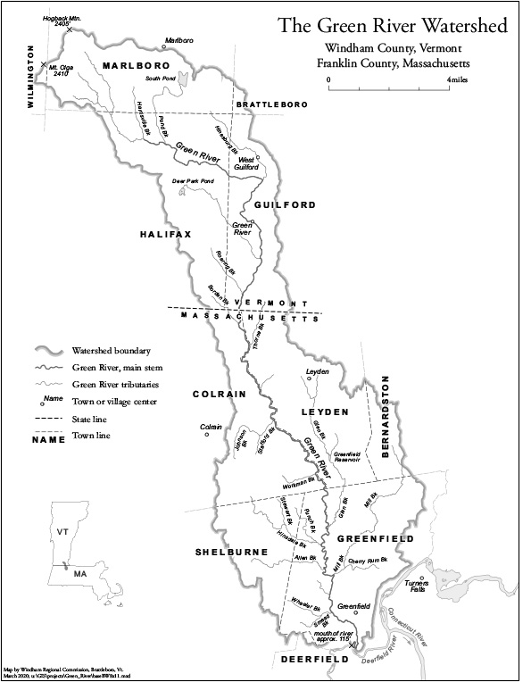
Green River Watershed: Its Mountains and Streams (physical features)
format: 11 x 17 inches, color, PDF
date: 2022
Did you know that more than 30 named water features (brooks, ponds, and reservoirs) and more than 30 named summits (mountains and hills, along with two pinnacles, a seat, and a head) dot the Green River watershed? Find them all on this map which highlights the watershed’s phyiscal features and their names in both Vermont and Massachusetts.
Green River Watershed base map
format: 8.5 x 11 inches, black & white, PDF
A simplified base map showing major streams with names, town boundaries, and major villages in the entire Green River Watershed (both Vermont and Massachusetts). Can be used as a base for thematic maps.
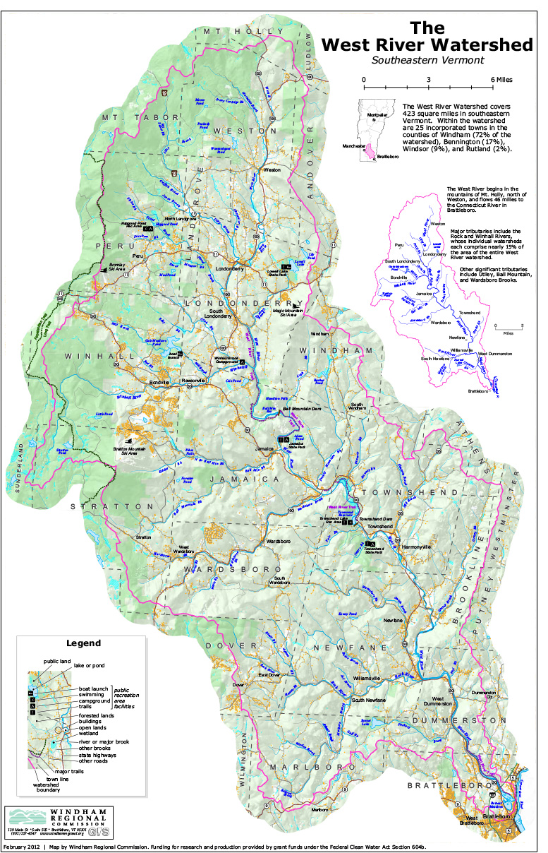
West River Watershed
format: 11 x 17 inches, 2 pages, color, PDF
A 2 page map. The first page is a richly detailed map of the entire West River Watershed, showing every named river, stream, lake, and pond in the watershed, along with wetlands, roads, buildings, villages and hamlets, public lands, and major recreation areas and trails. The second page introduces the concept of a watershed, and presents information on water quality, and special designations of lands and waters in the watershed. Funding for research and production provided by grant funds under the Federal Clean Water Act Section 604b.
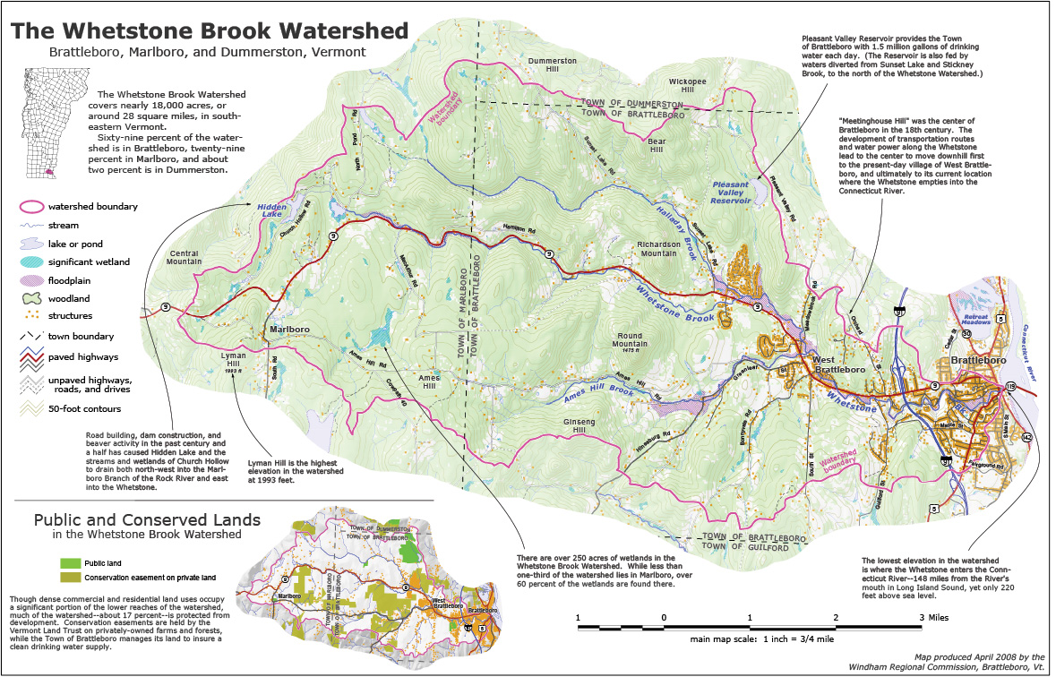
Whetstone Brook Watershed
format: 11 x 17 inches, color, PDF
This map shows the entire Whetstone Brook Watershed in Brattleboro, Dummerston, and Marlboro. It includes all streams, roads, buildings, forests, wetlands, floodplains, contours, and interesting and important facts about the watershed. An inset map depicts conservation lands in the watershed.
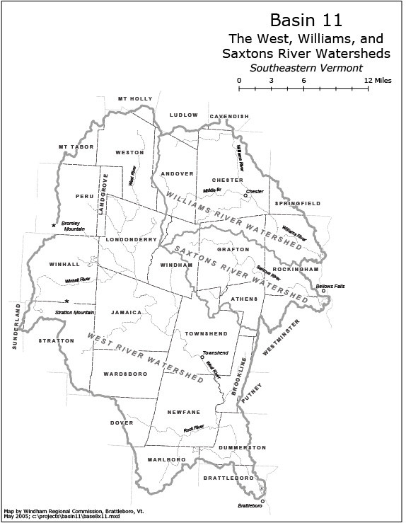
Basin 11 base map (West, Williams, Saxtons Rivers)
format: 8.5 x 11 inches, black & white, PDF
A simplified base map showing major streams, the three watersheds watersheds in the basin, and town boundaries. Can be used as a base for thematic maps.
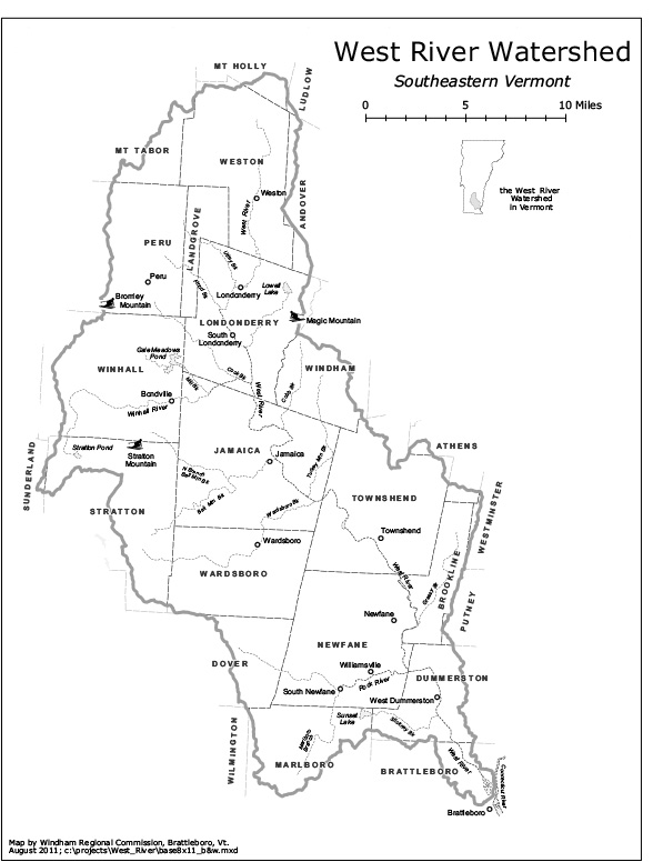
West River Watershed base map
format: 8.5 x 11 inches, black & white, PDF
A simplified base map showing major streams with names, town boundaries, and major villages in the West River Watershed. Can be used as a base for thematic maps.
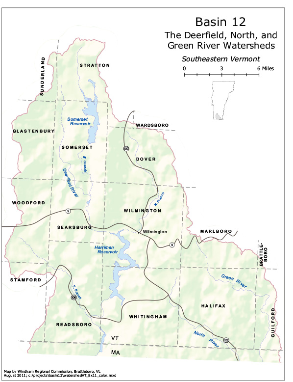
Basin 12 (Deerfield, North, Green Rivers), Vermont portion
format: 8.5 x 11 inches, color, PDF
A simple base map showing major streams, major roads, and town boundaries of Basin 12 in Vermont.
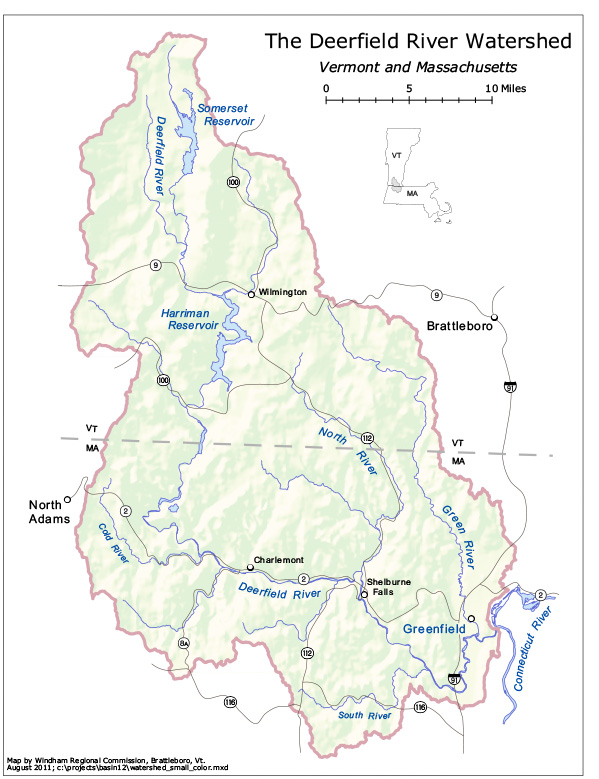
Deerfield River Watershed (Deerfield, North, Green River watersheds), Vt. and Mass.
format: 8.5 x 11 inches, color, PDF
A simple base map of the entire Deerfield River watershed in both Vermont and Massachusetts, showing major streams, major roads, and town boundaries.